Wednesday, December 21, 2005

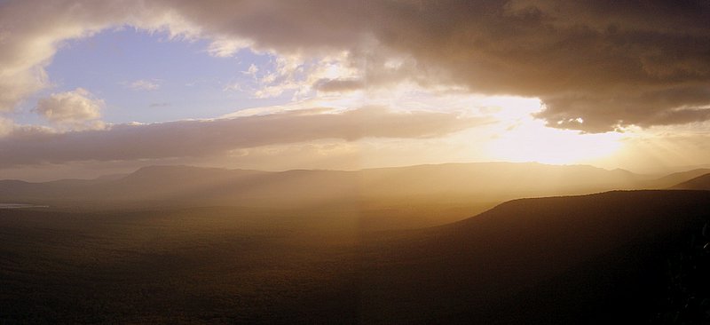
Kruger National Park, Mpumalanga and Limpopo, South Africa

Although “Kruger” is one of the world’s premier wildlife parks, populated by thousands of elephants, and just about every other animal found in Africa, somehow the name seems distinctly unAfrican. It almost conjures a picture a huge bruiser with biceps large enough to punch me into next year.

Yet, the park, which is over a hundred years old, takes its name from Paul Kruger, who issued a proclamation establishing it in 1898. At first, it was much smaller and consisteted of the Sabi Game Reserve, a 4,700 square kilometre cross-section, delineated by the Sabie and Crocodile rivers.


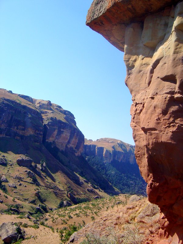
Since foundation the park has grown steadilty, combining a number of adjacent reserves. There's a granite memorial with a bust of Paul Kruger in the park.

More information can be obtained on
http://www.krugerpark.co.za/ and also at the official site http://www.sanparks.org/ which has everything you need, ranging from distance tables to maps and trails and various amenities. The South Africans represent best practice in provision of information to park users. In fact, they put our national wildlife websites to shame. Check out http://www.sanparks.org/ and compare this with the pathetic NSW wildlife site at http://www.nationalparks.nsw.gov.au/

The SA sites give you everything, even waypoint coordinates. For example, 31.80064 -23.9963 are the coordinates for the Satara Camp which I stayed at. Try getting that or even a trail map from the NSW sites.

How to get there

Drive along the N4 from Joberg, passing through Witbank, all the way to Nelspruit and finally to Komatipoort about 490 kilometres away. That will place you at the southern most gate of Kruger National Park, the Crocodile bridge gate. More detailed directions on how to get to each gate appear on the above listed websites. Once you're at Nelspruit the way to Kruger are well sign-posted.


I told my kids that I had to get up so early in the hope of spotting a big cat, that the mules where still in pygamas.


Blue Wildebeest (above)
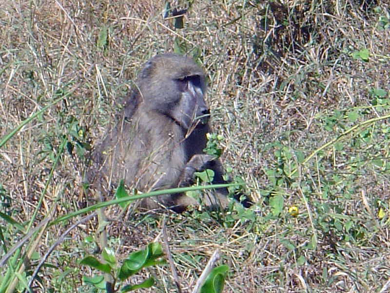


Baboon (above)

Ten minutes after entering the park in an area not normally known for elehants, I run into this guy (see below.) Most of the elephants are in the middle of Kruger, around the Oliphants river.

As I said above, I'd entered at the crocodile bridge gate and came out a couple of days later near the top, emerging from the Punda Maria Gate (in Limpopo) and heading back to Johannesburg via Polokwane (or Peterburg). While there I stayed at the Oliphants and the Satara camps.

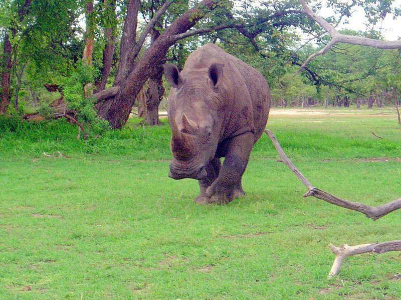
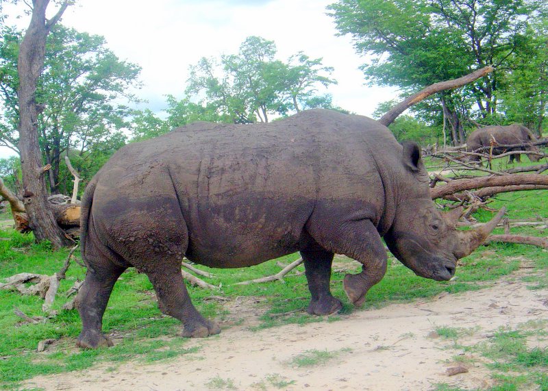
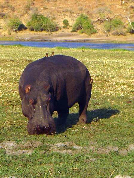
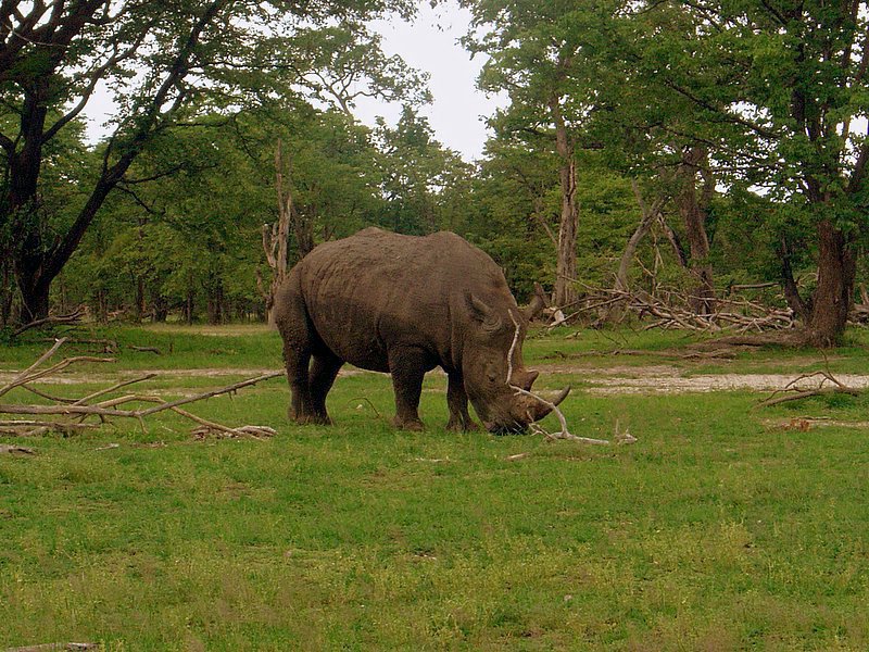
The facilities at Oliphants and, generally throughout the park, are excellent. Each of the camps is walled and, is in effect, a small town with all the creature comforts of home. I saw plenty of elephants, hippos, rhinos, but no big cats. To see them you need to go on one of the game drives.

The Oliphants camp takes its name from the Oliphants river. The Camp directly overlooks the Oliphants river which is around 100 metres above it to the east. The accommodation at Oliphants is reasonably new too. There is a viewing area just under the restaurant where you can see up to dozen of elephants congregate in the water below. In fact, the area surrounding the camp is full of them.

Anyway, I had a fantastic time. Ciao to Isabella who I met at Satara.

(Love is in the air, below)

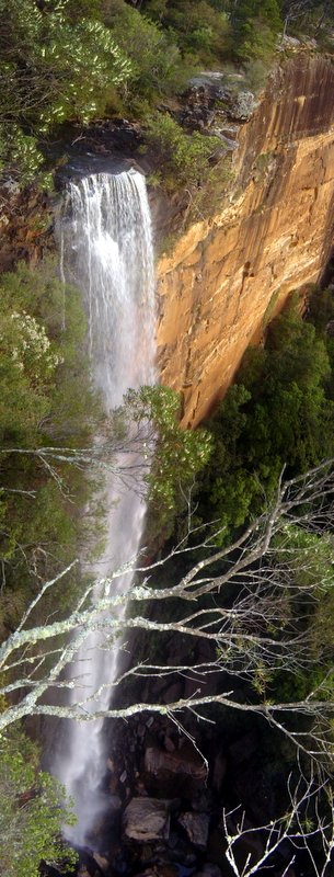
Enjoy the photos.(Click em to enlarge em).

Tuesday, December 20, 2005


My Old Muddy Boots

I’m a man with no roots,
I am he, who faithfully wears these muddy old boots

How can I let you go
when you’ve carried me atop Kosciusko
and in the winter bleak,
all over Mount Stirling’s frosty peak,
heel compressing the snow.
It seems cruel to now toss you out so.

Together we've explored the majestic Drakensburg,
and in Mosi-O-Tanya, surveyed the savage herd.
In Vietnam, you’ve carried me through Ho Chi Minh’s chaos
and across the serene foothills of luscious Laos,
through the streets of Hoi An
and the throng of Da Nang,

Foot in boot, we’ve kicked aside the stones of the Kalahari,
and we have gone for a stroll in downtown Nairobi.
In Masvingo, we meandered about in the ruins of Great Zimbabwe,
and how you squeaked on the dark volcanic sands of Bali
Oh my boots so old and so dear,
do you remember when I christened you with beer
to bless my trip to Zanzibar
or as I set a course to a new different star.

And while you’re ten years old
and the damp and cold
now creep into my toes
there’s no way I’m saying “out youse goes”,
to the dear old muddy boots
of this man with no roots.


Thursday, December 15, 2005

Golden Gate Highlands National Park, Free State, South Africa


I'm not sure quite how I got there, but I believe I drove along the N6, coming down from Gauteng to the Free State. It was an easy three hour drive from Johannesburg. As usual I abused my company car and hammered the Jetta. From the Free State it's possible to do a round trip of the highlands, taking in Lesotho as well. Unfortunately, I find it impossible to be that organised. I need to marry an organised woman. I'm sure that I passed through Villiers, Harrismith, and Clarens. My speciality is in finding my way out of the shit when I'm lost. That's a skill you need to acquire if like me you're the sort of guy who could lose a button in matchbox.

Or then again maybe I didn't go down the N6. The route I took skirted the mountainous eastern flank of the Free State. This region is the conservative heartland of Afrikanerdom, and it lies landlocked in the centre of South Africa. I traveled through the Free State a few times while I was working in South Africa in 2004.


Southeast of the Golden Gate Highlands National Park, you can drive to the Sentinel car park passing through the hike up to the highest plateaus of the Drakensberg - easier than starting from a much lower altitude in the Royal National Park. Clarens is by far the most attractive of the string of towns running along the Lesotho border. I stopped there to get something to eat on my first trip to the Free State. Clarens is full of arts and crafts shops and those artsy fartsy cafes that attract a well-heeled and cultured crowd.


Sadly I didn't have enough time to explore the Qwa Qwa National Park or the nearby Bashoto cultural village. Even worse, I had left my camera back in my car and didn't take any photos of the Golden Gateway Highlands National Park. The photos here where taken during my first trip with a friend, Johan Smith.

Anyone who has driven through the area will realise that the highlight of the Eastern Highlands is the Golden Gate National Park. This park is special not for its wildlife, but due to the spectacular Maluti Mountains with their stark red sandstone outcrops.

Enjoy the pictures. Click em to enlarge em. 1 Free State Panaroma 2. More Free State Vistas 3. Titanic Rock. 4. Me and my lovely Jetta. 5. Jetta abuse.

Monday, December 12, 2005

Chobe National park, Botswana


How to get there. Basically I drove from Johannesburg to Gaborone, the Capital of Botswana and caught an Air Botswana flight to Kasane about 5 kilometres from Chobe National Park.

Chobe is the second largest national park in Botswana and covers 10,566 square km. It takes its name from the Chobe river. Chobe has one of the greatest concentrations of game found on the African continent. Its uniqueness in the abundance of wildlife and the true African nature of the region, offers a safari experience of a lifetime.


The park is divided into four distinctly different eco systems: Serondela with its lush plains and dense forests in the Chobe River area in the extreme north-east; the
Savuti Marsh in the west; the Linyanti Swamps in the north-west the hot dry hinterland in between.A major feature of Chobe National Park is its elephant population currently estimated at around 120,000. Jesus! That's three times as many elephants as in all of South Africa. No wonder there's hardly any living trees in the place. Elephants are very destructive and tend to push over small trees to better reach to leaves. The Chobe elephants are migratory, making seasonal movements of up to 200 km from the Chobe and Linyanti rivers, where they concentrate in the dry season, to the pans in the southeast of the park, to which they disperse in the rains. As Chobe has no fence around it, the animals, including the lions, can roam about freely. I hired a 4WD to visit the northern section some 55 kilometres from Kasane and the Avis rep told me that two months ago there were lions just outside the loby of the Chobe Marine Lodge. One frequently sees elephants outside the park.


Chobe is often described as one of, if not the best, wildlife-viewing area in Africa today. It has of the highest concentrations of wildlife left on the African continent. Animals are present during all seasons, and at certain times of the year their numbers can be staggering. Especially the numbers of elephants. If you allow yourself adequate time here (a minimum of three to four days is recommended, I was there for five days) you will probably see nearly all the major species: giraffe, elephant, zebra, impala, tsessebe, roan, sable, wildebeest, kudu, buffalo, waterbuck, warthog, eland and accompanying predators including lion, hyena, jackal, bat-eared fox and possibly even cheetah and wild dog. I saw all but cheetah and leopards. There are plenty of hippo vultures and crocks. Savuti is famous for its predators, particularly its resident lions and spotted hyena populations. Mosquitoes are prevalent throughout the park and you need to take
anti-malarials and use generous quantities of insect repellent.


It's hard the do Chobe justice. It's beautiful and the wildlife is abundant. In many parks its hard to see elephants, but in Chobe there are so many that you literally must try to stay out of their way. Chobe comprises four main areas: the Chobe river frontage, the central pans around Nogatsaa, the Linyanti wetlands and the famous Savuti region that includes the Mababe Depression.

I did the river front by ferry and safari and I hired a 4WD and did the the Savuti.


Pictures:
1. Chobe elephants. 2. Wild dogs 3. Elephant
Elephant carcass, Chobe river front, 4 Zebras on the Savati,
5. Some type of African Tree (not very informed of me) 6. Calf suckling, 7. Hippo on Chobe river, 8. Giraffe (Savati). 9 Crocodile in the Chobe River
The Drakensberg, Kwa-Zulu Natal, South Africa

The majestic Drakensberg is South Africa's most impressive mountain range. At it's highest points it exceeds 3 000 metres. The Zulus call the Drakensberg, "Ukhahlamba" or" the wall of spears". In Afrikaans it means, "the home of the dragon". The Mountains provide a magnificent semi-circular border between KwaZulu-Natal and the mountain kingdom of Lesotho. Most of the villagers living around the Drakensberg are not Zulus but are Sotho.

The basalt peaks divide the rains and snows, some flowing westwards over the alpine plateau of Lesotho towards the Atlantic Ocean, and some down the frequently vertical slopes into KwaZulu-Natal, towards the Indian Ocean. The Drakensberg range is the source of the Tugela River, the largest river in the KZN, and it plunges some 2 000 metres over the edge of the Mont-aux-Sources Plateau in a spectacular waterfall. This waterfall, called Tugela Falls, is the second highest waterfall in the world.

Most of the Drakensberg falls within the Natal Drakensberg Park, a wilderness area with an abundance of wildlife. In the three days I spent walking there, I walked within 10 metres of bushbuck, mountain reedbuck, and baboons. Overhead, as I walked I could see enormous bearded vultures. I went in July and the weather was warm. There are no predators in the park so it's safe to walk through it.


My first day was in the northern berg in the vicinity of the Giant's Castle. It may have been the Singati Valley.

I took my GPS device, which is a Garmin e-trek vista. It came in handy. I decided to leave the trail and head up to the top of the plateau. I then walked to the Lesotho border and back. Unfortunate I didn't take enough water and a got into some difficulty. I was expecting the climate to be cooler than it was. I had just two 500 ml bottles and one ruptured. On the day I went it was extremely hot. I easily found my way back to the starting point but I couldn't get down from the plateau. I found the decsent would shift from a steep 45 degree decline into a sheer vertical drop necessitating a back track up to the plateau. After an hour and a half of doing this without a drink, I decided to walk back to the original point where I left the trail. Luckily I had taken a waypoint there. I was getting nowhere going back and forth like this. It was like being on a stepping machine at the gym for ninety minutes. Making that decision was depressing because I had backtrack and extend my walk by about three hours and I was in such a distressed state that I started to lose my peripheral vision. But there was clearly no way down.

My feet were really aching and felt like mush. When I finally got back to my car I slumped into the seat and sat there exhausted. I waited as long as I could, trying to muster the energy to drive to the visitor centre. At about ten to five I realized that the visitor centre was about to close so I drove there and bought some water, beer and an ice cream. I skulled a litre of water in about ten seconds flat and then I started on the ice cream. I couldn't even remember eating it, I just remember taking off the wrapper and then shortly after holding the wooden stick in my fingers.
Funny thing is that after I consumed the ice cream I felt a lot more energetic. But it was probably the water. My face looked like I had powdered it with flower and it was white from the salt streaks. I drove back home to "Little Switzerland" with my beer and spent the night recuperating. When I took my boots off my feet were't in bad shape at all. I didn't have any blisters but three of my toe nails were coming off.

I reflected on my many stupid mistakes. Mistakes I would never have made if I were hiking back home. The first was going alone in an unfamiliar area. The second was not bringing enough water, the third was leaving the trail and the last was walking too long than was feasible for a day trip. Normally, the hotel runs hiking tours but they need five people to make one worthwhile, and no one else signed up. So I had no option but go alone or lose the opportunity. I know it was foolish but I reasoned that would I probably never be able to see this place again.

This Drakensberg is incredible, it a world heritage listed site and has some of the most magnificent scenery you'll see.
I don't quite remember the name of the walk I did.…I'lI have to post it on later. Believe it or not, the next day I felt much better and drove to do a hike in the central berg. I secured my toenails back on with band aids. I went alone but this time I didn't leave the trail. I only went for a three hour hike because my joints, especially my knees where aching from the day before, especially on the desent.

Pictures: 1.Valley Vista 2. The Ampitheatre, 3. Drakensberg Panorama, 4. Sotho Village, 5. View from the Top, 6. No Way Down. Click on image to enlarge.

Sunday, December 11, 2005

Mosi-O-Tunya National Park, Zambia

I was in Zambia in December 2003. In 2003 and 2004 I was working in South Africa. Around Christmas I flew my family to Johannesburg and we arranged a holiday in Zambia. We flew to Livingstone and stayed near Victoria falls. I hired a car and we drove around the Mosis-O-Tunya national park which is situated situated along the upper Zambezi stretching from and including the Victoria Falls for about 12kms up the Zambezi River above the Falls. The park takes its name from the falls which were referred by the local tribe as "smoke on the thunder, "Mosi-O-Tunya". The Park is only 66 square kilometres but there are plans to extend it in future.

Because the park is small, it affords a serene drive alongside the river for much of the circular route and the wide variety of species can be easily seen. You'd have to be unlucky not to spot a giraffe, hippo or zebra. The Park has the only white rhino in Zambia. Believe it not there's just three. The others were all wiped out by Poachers.


In fact, these rhino graze like royalty constantly flanked by soldiers with AK 47s. It's rather odd to watch the party of five soldiers who walk like an armed escort around the rhinos following them as they graze.
The soldiers walk within ten metres of the Rhino's.

We drove around the park in a little red Dawae as all the 4WD were taken.

The soldiers (or were they wildlife rangers) obligingly move out of the way when you want to photograph the Rhinos. Around 6pm a herd of elephants regularly cross the Zambesi river. I drove to the crossing point but didn't see them having just missed them as they crossed. The park has no predators and so its generally safe to get out and walk as long as you are away from the river and the hippos.


Pictures: 1. Victoria Falls, 2 and 3. Mosi-O-Tunya Rhino

Wednesday, November 30, 2005


The Grampians National Park, Victoria
How to get there. The Grampians are just over 258 kilometres from Melbourne. Drive to Geelong and take the A8 to Stawell and then turn off to Halls Gap. At Halls Gap there's an excellent information centre with maps on the main walks. Stawell also has a good information centre so it's worth stopping there as well.
The Walks. I've done quite a few so I won't comment on any particular trail. I'll do that later. The Grampians consist of a main system of ranges encompassing some 167,000 hectares. It has everything; magestic waterfalls, a kangaroo feeding ground, spectacular summit vistas, ancient Koori art sites, such as the cave of fishes and the sublime cave of hands, to name just two. Then there's the many other heritage sites such as the houses of the German pioneer families. There's a good range of accomodation available at Hall's Gap which is a great place for a long weekend devoted to walking. I've attached a few pics taken from my many trips there in 2004 and 2005.

The Pictures: 1. Grampian's Sunset, 2.View from Mt William on Misty Day, 3. The Jaws of Death, 4. Mossy Tree on Mt William, 5. Cave of Hands. 6. Me on Road to Halls Gap.

Tuesday, November 29, 2005

Cape Conran Coastal Park, Victoria

This is surely one of the best coastal parks in Victoria. You can book accomodation within the park but it's in strong demand so you need to book around six months ahead of your trip. There's a series of Cabins with showers in the park. Each cabin even has a functional Kitchen including a refrigerator and accomodates around six people; four sleeping bags in the loft and two below.

How to get there. Cape Conran is a long way from Melbourne, situated in the far East of Coastal Gippsland. To get there you head along the Princess Highway, past Orbost or Marlo, and take the turn off to Cape Conran using the Conran-Cabbage tree Road or the Cape Conran Road. The park is reasonably close to the Snowy Mountains National Park too, so it can be a useful base to explore that Park as well as many others such as the Begg River National Park, the Errinundra National Park and the Lake Tyers Forest Park. The last three are quite close to Cape Conran. Having said that, I should tell you that I consider anything within a forty minute drive to be "just next door". Once there, you can do a variety of coastal walks. But there's also a number of inland walks with heathland, woodlands (the trees are quite small, must be the sea air). You can also do a walk to Teerung Gorge which I didn't have time to do.
If you come to Cape Conran you'll want to do make sure you do the coastal walks. You get the some mystical views walking along the coast from the East Cape along the Yeerung Beach near the Yeerung River. If you continue along to the East Cape you'll see an interpretive boardwalk that details the area's coastal Koori culture. The best time to do this is early morning or at sunset. You'll get some great photos too.
Pictures: 1.Harsh Coast, 2.Marine still life, 3 and 4 View of Yeerung Beach, 5 View taken walking towards the East Cape from Yeerung Beach.

Wednesday, November 23, 2005

Lake St Claire National Park, Tasmania

How to get there. I flew from Melbourne to Hobart and drove a hire car from Queenstown staying at Strahan. The journey from Queenstown to the Cradle Mountain visitor centre took a little over two hours. That's taking it easy. It's about 125 kilometres in all, traveling on the A10 and then turning into the C132 to arrive at the Park. You should take your time because the roads are terrible. The roads in Zimbabwe are better. Seriously!

The walk. You can drive to the car park near the main lake, but it's often full. This park gets an incredible number of visitors from all over the world. It's not unusual to hear French, German or Japanese spoken on the shuttle buses that depart the visitor centre. There are eight shuttle buses in all carrying people to the various walks. The final stop is Lake St Dove which is at the base of Cradle Mountain. There' s such strong demand for the buses that you generally have to wait a while to get back to the visitor centre. Despite the wait, this park is truly exceptional. And one must say that the excellent organisation and amenities enhance the experience.

I did the Lake Dove walk and then did the walk to Lake Lila. Cradle Mountain takes its name from the sort of cradle used to separate gold from silt rather than one found in a nursery.

This park is beautiful and I'm so glad I got to see it. Sadly, I had little more than a day to spend there. I really would have liked to have seen more. Overall, the experience is superb and the good organisation is a real credit to the park management. One day I'll do the 65 kilometre overland trek from Cradle Mountain to the Lake Saint Claire (which takes six days).

Good information can be obtained from the Tasmanian Parks and Wildlife Service portal. The information is hard to find but it's all there at: www.parks.tas.gov.au/natparks/stclair/activities.html. There are even downloadable maps. These aren't any good for walking, however so you'll need to buy more detailed maps at the visitor centre.

Pictures: 1 Strange kind or tree fern, 2. Cradle Mountain as seen from the beginning of the walk. 2. Another view of Cradle Mountain from lake Lila. Click on a picture to see an enlargement.


Tuesday, November 22, 2005

Morton National Park (Mount Bushwalker)
New South Wales


How to get there?

Drive 20 kilometres past Milton and turn off at the little dam road...I think that's the name of the road. I must admit I don't quite remember now. I'd recommend you call into the information centre at the Ulladulla library. They'll supply you with map and some good advice.

The Walk

Strictly speaking this walk is not part of Morton National park. It's on a reserve adjoining the park. This means there's no visitors fees to pay. By the way, did I mention that I love that name of that town "Ulladulla". Heck! I might just get me a pet pig and name him "Ulladulla". Why a pig, you ask? Because Ulladulla is no name for a dog, that's why! And it befits a pig.

Actually, Ulladulla is not "bogun" at all. It's more a coastal tourist town than a rural community. In fact, the only thing that suggests country is that the town appears to be named after a pig. But enough about Ulladulla. Back to the walk . This exquisite walk, called the Mount Bushwalker trail, is not on the national parks site for Morton NP. There's nothing much on that website. Sure there's the park management plan and other useless stuff. Do you think they have a comprehensive list of walks or a map you could download. No way. And look at the information on the site:

For Example go to
http://www.nationalparks.nsw.gov.au/parks.nsf/ParkContentByDistance/N0022?OpenDocument&ParkKey=N0022&Type=I

and see the following description taken from the website describing the pigeon house mountain walk with my comments in brackets:

"The climb to Pigeon House Mountain is very popular. From the top there are magnificent panoramic views of the rugged cliffs and gorges carved by the Clyde River and its tributaries. On a clear day, you can see the coastline from Point Perpendicular in the north to Mount Dromaderry in the south, making the walk a most rewarding experience. There are ladders to be negotiated at the top."

Holy shit! Do you mean they don't have an escallator? It's a good think they placed that bit of information on the site to warn me. Seriously, was this crap written with the needs of anyone who actually plans to visit the site in mind ? Is it worth telling people that you can see a panorama from the top of a summit or that you can see the coast which is a little more than 5 kilometres away ? As you can gather I'm rather pissed off....

Why am I talking about the Pigeon House? Well that's because I didn't plan to do Mount Bushwalker. I planned to do the Pidgeon House. The site could have told me that you can't actually get to the park on a rainy day if you don't have a 4WD vehicle. And surely they could also post updates of weather conditions? But there's nothing on the website about not being able to get there in a 2WD vehicle on a rainy day. That space is taken up telling you that you can see a panorama from the top. There's just a helpful sign on the trail eight kilometres before the start of the walk letting you know. It was really annoying given I had driven 165 kilometres and it began raining heavily. The NSW parks sites are generally very poor with no thought given to the needs of the park's users. Anyway, that's enough complaining. Hope you enjoy my pictures. The day ended well, because I discovered the Mount Bushwalker trail which is an outstanding walk. It's spectacular, well signed, easy to do and there are no park fees to pay.

I found the trail by dropping into the information centre at Ulladulla searching for an alternative to Pidgeon House. "Ulladulla", God! I love that name...There's nothing like local knowlegde and you can always get it at the local information centre.

Mt Bushwalker takes about two hours and it's a fairly level and easy walk. You could do it in crutches. How do I know? Because I actually ran into someone doing it in crutches. I felt so overdressed in my hat and pack that I actually thought about hiding them under my shirt. No kidding! I kept looking over my shoulder waiting for an octogenarian in a motorised wheelchair, or someone led by a seeing eye dog to, overtake me and completely deflate my sense of bravado. Anyway, it's an oustanding walk and you get a view of pristine wilderness without expending too many calories. The terrain in the valley has never been disturbed. There could be fairies down there. Well, that's what the locals say. But then again, I'm not the type who believes in fairies, ogres or eskimos.

Pictures:view from the end of the Mt Bushwalker trail. Fitzroy Falls,(near Cowra), Wilderness area. Click on pics to emlarge.
Enyoy the pics.

Sunday, November 20, 2005

Monga National Park (New South Wales)


How to get there
Drive via Queanbeyan to around 20km past Braidwood and there you'll
see the turn off for Monga National Park. The park is 105 kilometres from
Canberra on the Kings highway.


The plan
There's a variety of walks here but being lazy I decided on the corn trail which I reasoned trailed the river. That plan was foiled by a need to cross the Mongarlowe River which would have meant wet feet. I'm prepared
to endure some hardships but not on a Sunday. Not on my day off. Reluctantly, I resigned myself to a walk which required an ascent.


So I drove down the River Road, which is an unpaved 2WD loop and went
for a brief eight kilometre walk down an unknown track. I saw some interesting birdlife. Jesus! I realise that I'm starting to talk like Tweetie's owner but I did see a very pretty wren with orange plumage. They are very curious and let you approach within six feet of them before they fly off. O.K. That's enough bird talk. I have to admit that I couldn't be stuffed looking it up and finding out what it is. That's probably the sort of thing that a vegetarian with spectacles sporting lenses thicker than bullet proof glass does. If I did that sort of thing, I'd probably be in danger of following up the sighting with a dance of joy or even taking up lawn bowls. I did see an Echidna on the day and took a picture of the little guy from a distance of less than a foot. I went alone today which was a drag. On the other hand, not having reached the stage where I talk to myself yet, I was reasonably quiet and saw
a few animals as a result.


After my grunt walk along an unnamed trail I then walked to a place called Penance Grove which has a brief platform walk around a section of forrest that was stripped of tree ferns by some unscupulous bastards. The area got fairy misty which is always good for photographs. Monga is well worth seeing. It's essentially a subtropical rainforest very much like the Otways or parts of the Yarra Ranges. There's lots of ferns, even a few tree ferns. The area shows evidence of logging with many tree stumps and fern-ladden gaps in the forrest highlighting the selective felling of trees. A mill operated in the area until 1987. It was closed when it become unprofitable in 1988. Monga is a comparatively
new national park being established at late as 2001.


Pictures
1. Misty Forrest 2. Mongarlowe River at Crossing on the corn track 3.
Split log 4. Mongarlowe river near Penance grove. 5 Misty Marsh 6. Echidna
7. Penance Grove (Click hotos to see enlarged images.)