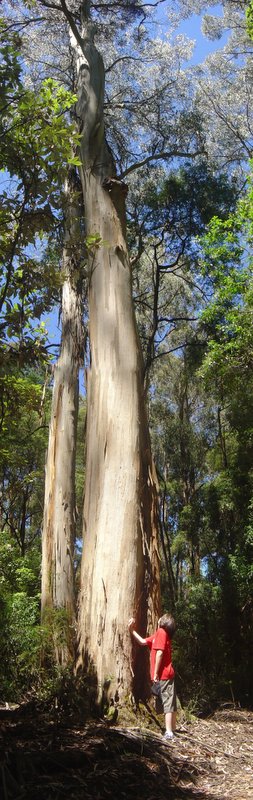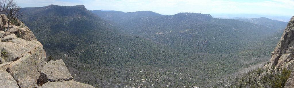
Pictured above is a view from Booroombra Rocks. This shows 6 images pasted together using photostitch.
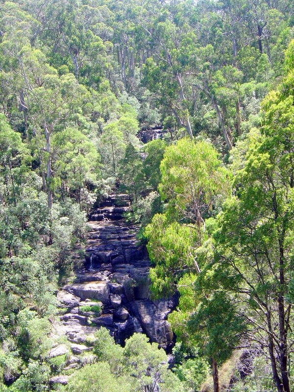
Walking through Namadgi National Park one can see evidence of both sandstone and granite formations. The oldest exposed rocks in the Namadgi park area are sedimentary sandstone, mudstone and shale. These were deposited between 470 and 440 million years ago during the Ordovician Period. In some of the rock formations here, the remains of small marine animals called graptolites have been found. These remnants indicate that the sediments were deposited in fairly deep seawater. At that time most of southeastern Australia was underwater. Forgive my ignorance but I'm not sure whether it would have been part of the Tasman or the Atlantic. Even though Namadgi is close to Canberra and is, in fact, the only National Park I'd visited in the ACT, it's taken me some time to get to there. Perhaps that's because I simply cannot equate a good time with remaining in the ACT. Perhaps in part, it's because the 2003 bushfires which devastated much of the park lead me to expect some fairly drab scenery and reduced its appeal. I guess I was curious about the countryside and I was interested in seeing how much damage had been done to the park. Fire is a natural occurance in the park but the severity and damage caused by the 2003 bushfires was without precedent. The areas comprising Namadgi NP collectively amount to 106,000 hectares and make up almost 45% of the land area of the Australian Capital Territory.
Now that the growth of Canberra has pushed the population to 335,000 people, the park is destined to be an environmental flashpoint around water and land use. In fact, I saw plenty of placards in the park (or perhaps private land) protesting the dam proposed for the Naas river. The human intrusion is evident when one considers the proximity to to new housing in the Tuggeranong valley.
How to get there
Take the Monongo highway to Tharwa and then turn into the Nas Road. Drive a little while past Tharwa and you'll come to the Namadgi National Park visitor centre. The park is large and has many points of interest. I drove to the Northern part of Namadgi and did the short walk to Baroombra Rocks followed by a 12 kilometre walk along the Old Boboyan Road. All of the photos are of the Baroomba Rocks walk.
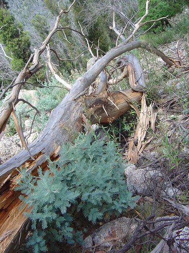
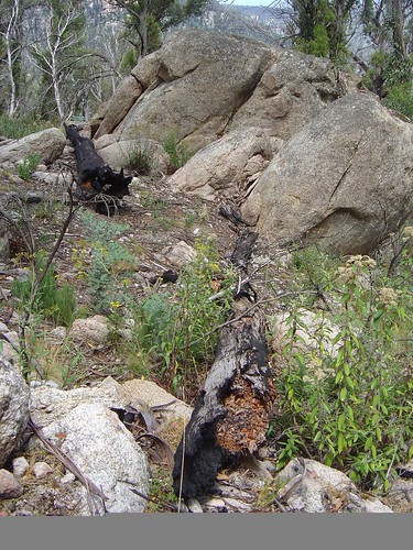
Above: New gowth amongst the remains of a dead firedamaged tree
Geologicial History
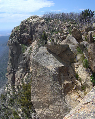
Having been underwater for most of the Silurian period, towards the close of the Silurian period approximately 400 million years ago, the area was intruded by a huge body of granite known as the Murrumbidgee Batholith. The many fantastic granite boulder formations that are to be found in the park resulted from this intrusion. There were major earth movements throughout the whole of southeastern Australia between 400 and 350 million years ago. Rocks were folded and raised into high mountains by tectonic forces. A walk along the Yerrabi Track in the southern end of the park reveals two distinctive geological zones that meet near the Boboyan Trig. The eastern approach to the trig consists of sedimentary rock laid down when the area was under the sea. To the west is granite that intruded into the sedimentary rock. The sedimentary rock overlaying the granite has now worn away, exposing the weathered boulders seen today.
Namadgi has a rich heritage of human history. A rockshelter at Birrigai, just north of Namadgi National Park, contains evidence that Aboriginal people were living in the region during the last ice age 21 000 years ago. That’s actually in the Tidbindilla nature reserve. Clues into the lifestyle of the local indigenous people are found throughout the park. These include quarry sites where stone was gathered for tool making, campsites with discarded fragments of stone and animal bone, ceremonial stone arrangements on the high peaks, and rock painting sites. Other information comes from the journals of 19th century European settlers written in the brief period before the Aboriginal people were decimated by introduced diseases, and dislocation from their lands.
The first pastoralists settled in the broad valleys at the southern end of the park in the 1830's. They faced a struggle to establish themselves in a remote area subject to severe weather. Today the story of their efforts is told by the fences, yards and homesteads that remain. In the 1860's fortune seekers travelled the Kiandra gold trail from Tharwa to Yaouk. Parts of the trail are still visible in the Gudgenby area. Space tracking stations operated from the early 1960's to the early 1980's at Honeysuckle Creek and in the Orroral Valley. They were instrumental in monitoring the Apollo program. Honeysuckle Creek was the first place on earth to receive the images of Neil Armstrong, the first man to walk on the moon. Today the site is abandoned.
Flora
Namdgi has a wide range of plants, many of which are found only in Australia's alpine and sub-alpine environment. Even along a short walk, vegetation and wildlife can change dramatically, particularly with increasing elevation or a change in aspect.
Woodlands
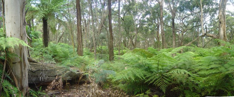
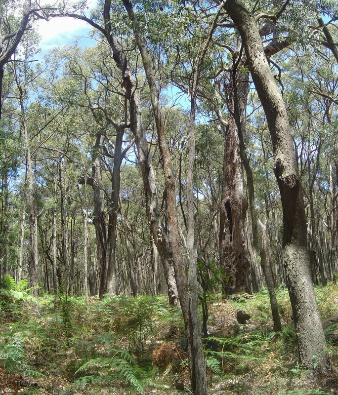
Low open woodland covers most of the park, although a great portion were damaged in 2003.
Broad-leaved peppermints, as seen along the Boboyan Road, dominate the lower altitudes whereas snow gum woodland, as seen along the Mt Franklin Road, is found at higher altitudes. Wet forests occur in the sheltered locations, especially on the western side of the park. Stands of ribbon gum follow watercourses; alpine ash grow on suitable south-facing slopes; and brown barrel eucalypts tower above tree-fern gullies.
Above : Another view from Booroombra Rocks
Large open grasslands occur on the eastern side of the park such as the Orroral and Boboyan valleys. These grasslands were extended by graziers last century and sown with introduced grasses. They remain treeless due to the cold air that drains off the hills at night; frequent frosts make it difficult for trees to re-establish. It was diffficult to gain insight into what the park was like, as the areas I visited had sustained heavy damage from the 2003 bush fires. There was substantial evidence of fire damage and regrowth in the areas I walked through, the grasslands as one would expect are quite resilient and show no evidence of bushfire.
Below: Dead Trees and regrowth
Fauna
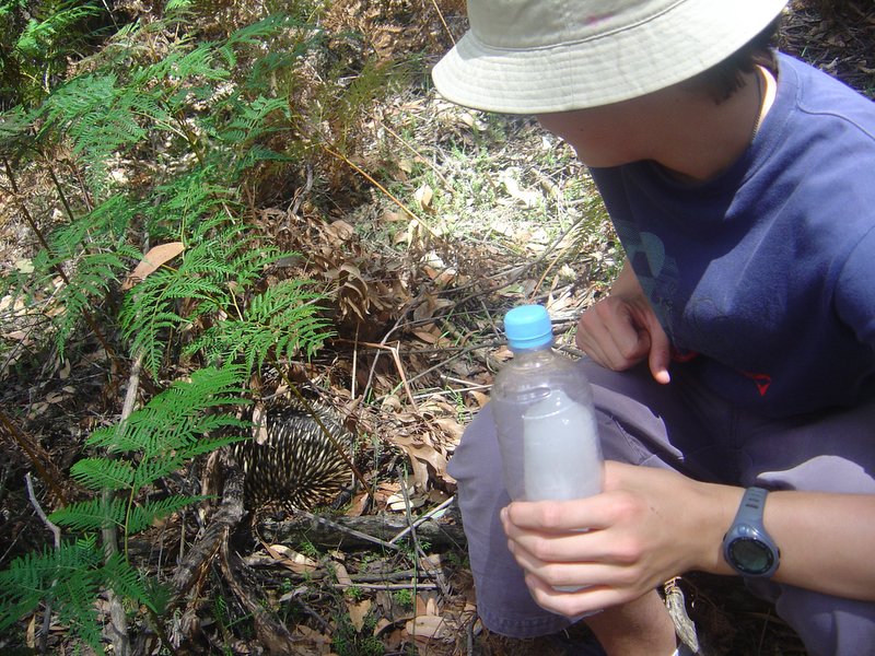
Namadgi provides a habitat for a wide range of native fauna. Over 222 species of vertebrate fauna have been recorded to date with several threatened and rare or uncommon species. For example the broad-tooth rat Mastacomys fuscus, northern corroboree frog Pseudophryne pengilleyi and river blackfish Gadopsis marmoratus. The northern corroboree frogs live exclusively in the subalpine areas of Namadgi and adjacent parts of NSW. They are currently under threat of extinction. I didn’t see any animals on this walk. Just a few skinks and there was an absolute plague of Mountain grasshoppers. I did spot a group of gang gang cockatoos.
This was my first visit to the park. All in all, it's been a good experience.